



Darkness Of The Donbas: Nighttime Satellite Images Capture Ukraine's Depopulation
- By Amos Chapple
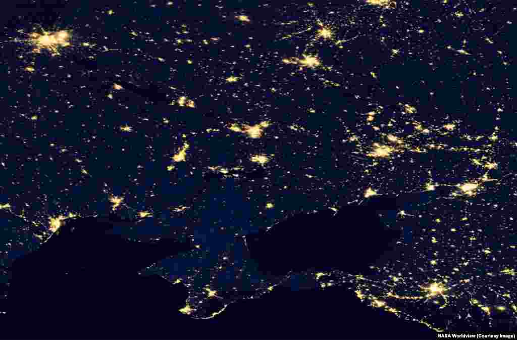
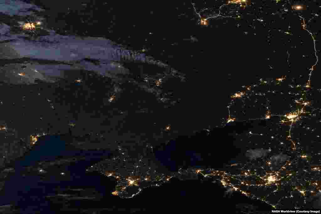
Colorized images made by NASA satellites capable of capturing the light of human activity by night show swathes of Ukrainian territory in the country's east have fallen dark amid depopulation and wartime power outages.
Then
Now
1
Nighttime views of southeastern Ukraine and western Russia seen on June 14, 2012 and April 27, 2026.
Today swathes of Ukraine's once bustling Donbas region are plunged into darkness after sunset due to a combination of wartime power outages and depopulation. The Donbas region has seen millions of its residents flee conflict there since 2014.
Today swathes of Ukraine's once bustling Donbas region are plunged into darkness after sunset due to a combination of wartime power outages and depopulation. The Donbas region has seen millions of its residents flee conflict there since 2014.
Then
Now
2
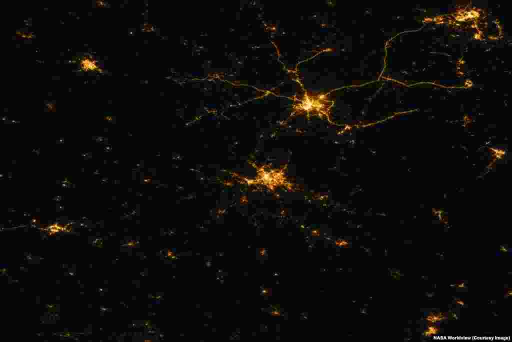
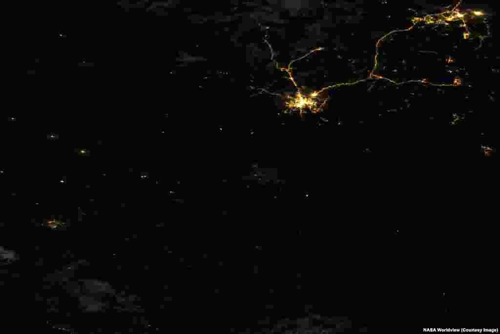
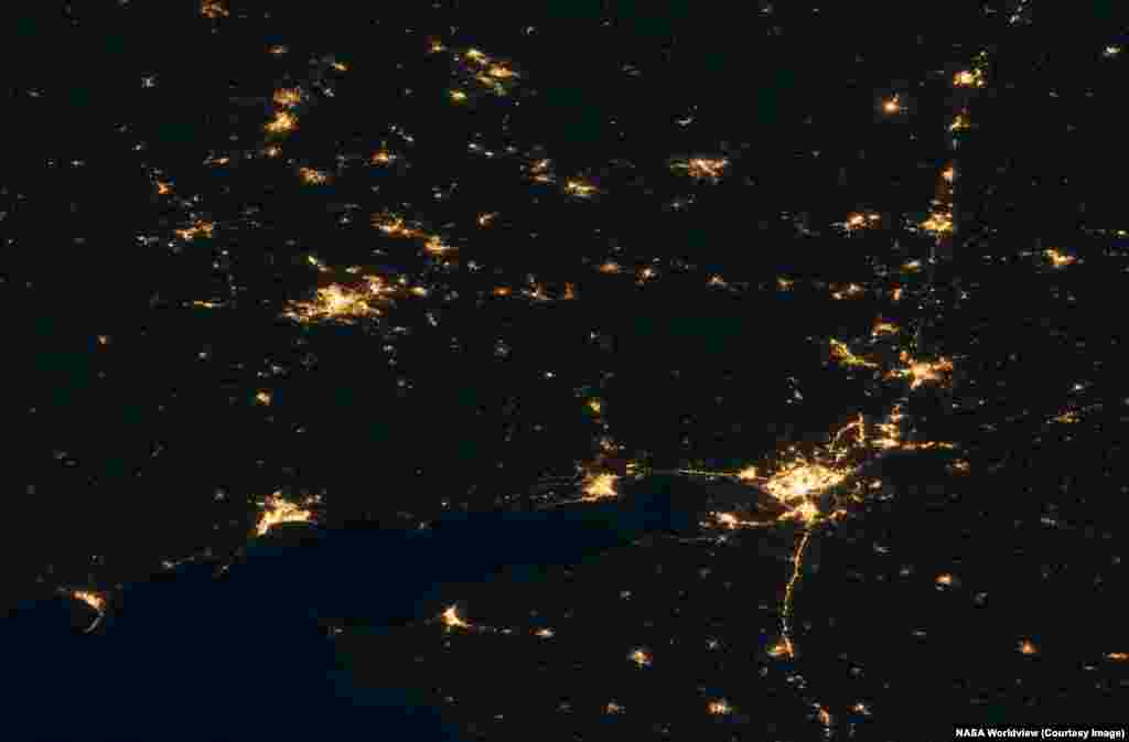
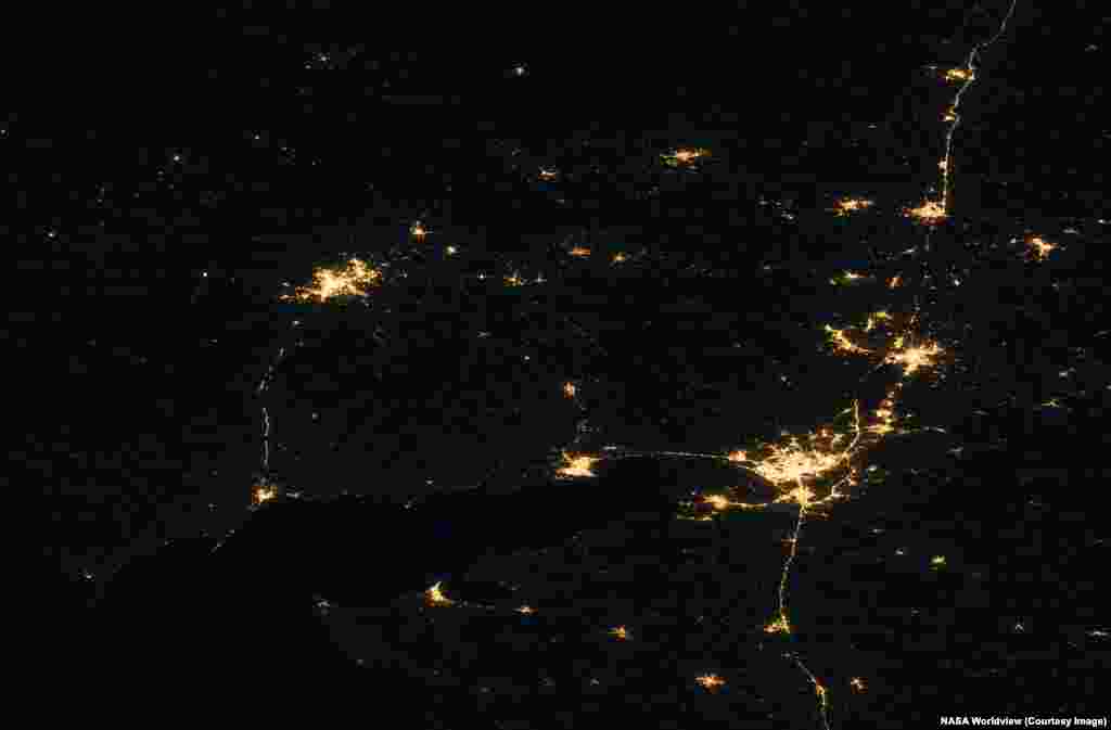
The northeastern Ukrainian city of Kharkiv (center of this image) is difficult to spot in a nighttime satellite image made on July 5, 2026. Just to the northeast, Russia's Belgorod and its well-lit highways appear largely unchanged from the historic photo, made in August 17, 2021.
Then
Now
3
Ukraine's Donetsk Region, taking up roughly the left third of this image, and part of the Luhansk region (upper center) are seen next to Russia's Rostov region (right). The nighttime pictures were made on October 26, 2021, and July 1, 2026.
Several towns in the top left of the historic image, which lie in Ukraine's Donetsk region, have fallen dark, while the bright lights of Russian-occupied Donetsk (upper left) remain largely unchanged. South of Donetsk, the now Russian-held city of Mariupol is visible at lower left of the image. Russia's Rostov-on-Don is the large city seen at lower right.
Several towns in the top left of the historic image, which lie in Ukraine's Donetsk region, have fallen dark, while the bright lights of Russian-occupied Donetsk (upper left) remain largely unchanged. South of Donetsk, the now Russian-held city of Mariupol is visible at lower left of the image. Russia's Rostov-on-Don is the large city seen at lower right.
Then
Now
4
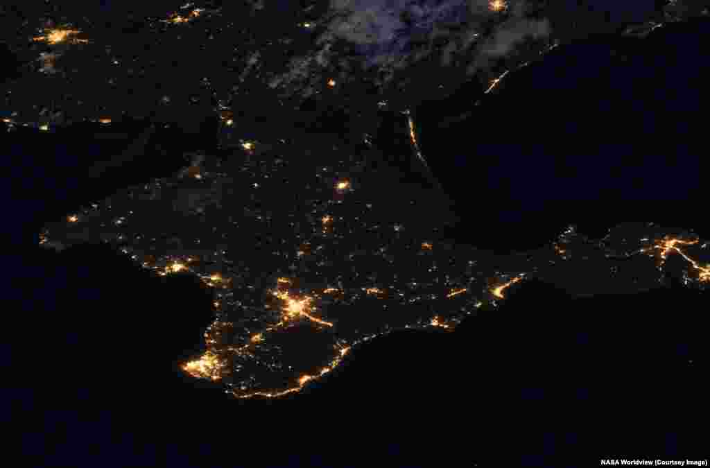
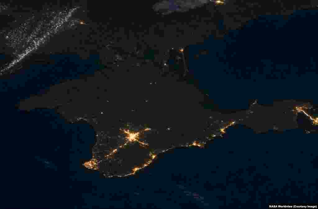
South of the Donbas, on the Russian-held Crimean Peninsula, darkness recently prevailed in many areas due to an ongoing Ukrainian drone campaign targeting Crimea's electricity network. These images were taken on July 8, 2021 and July 3, 2026.
Then
Now
5
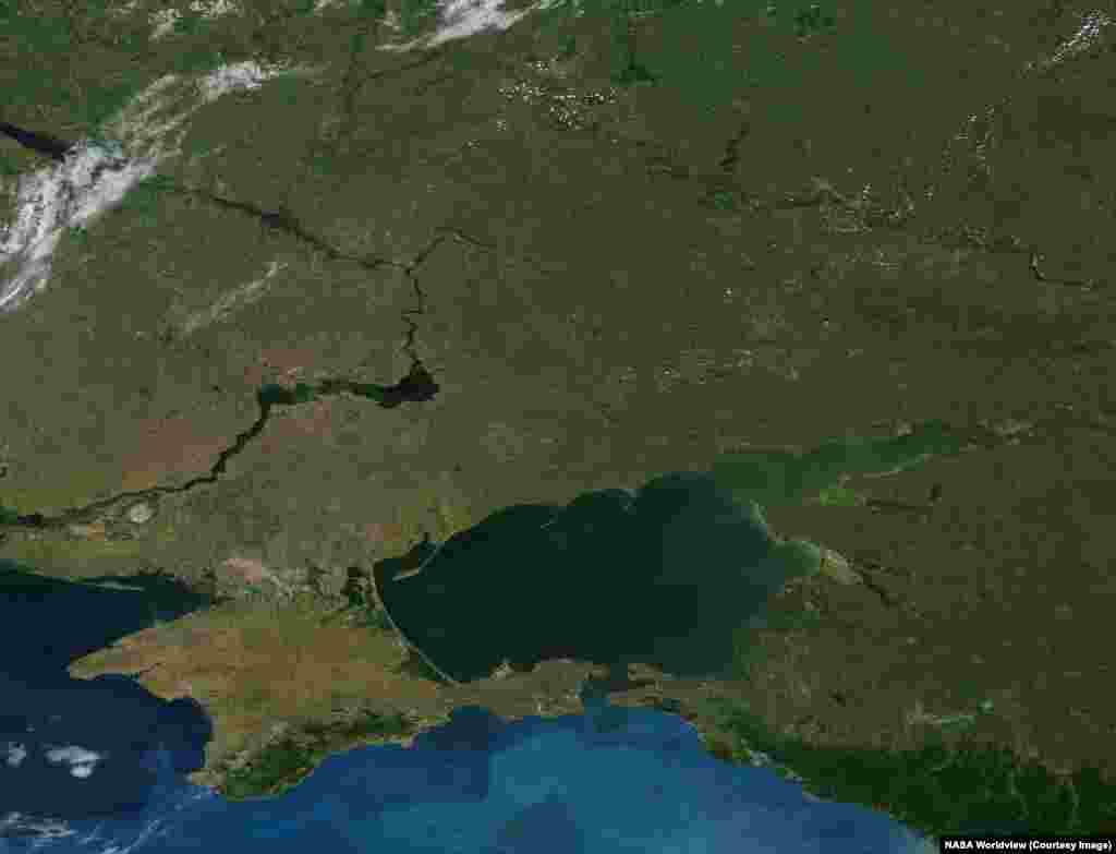
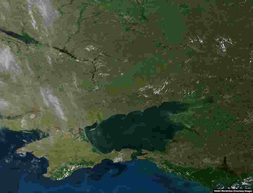
By day, NASA satellites have captured other momentous effects of Russia's ongoing war on Ukraine.
These images of southeastern Ukraine and western Russia that were made on June 14, 2012 and June 6, 2026 highlight the disappearance of the water reservoir (center left) that stretched northeast of the Kakhovka Dam on Ukraine's Dnieper River.
The dam was destroyed on June 6, 2023 and its reservoir drained into the Black Sea. The 2026 photo also shows a band of green and untended land sweeping from the center of the image up to its top right, where the war's current front line stretches.
These images of southeastern Ukraine and western Russia that were made on June 14, 2012 and June 6, 2026 highlight the disappearance of the water reservoir (center left) that stretched northeast of the Kakhovka Dam on Ukraine's Dnieper River.
The dam was destroyed on June 6, 2023 and its reservoir drained into the Black Sea. The 2026 photo also shows a band of green and untended land sweeping from the center of the image up to its top right, where the war's current front line stretches.